RSS

Warrior Dash New England

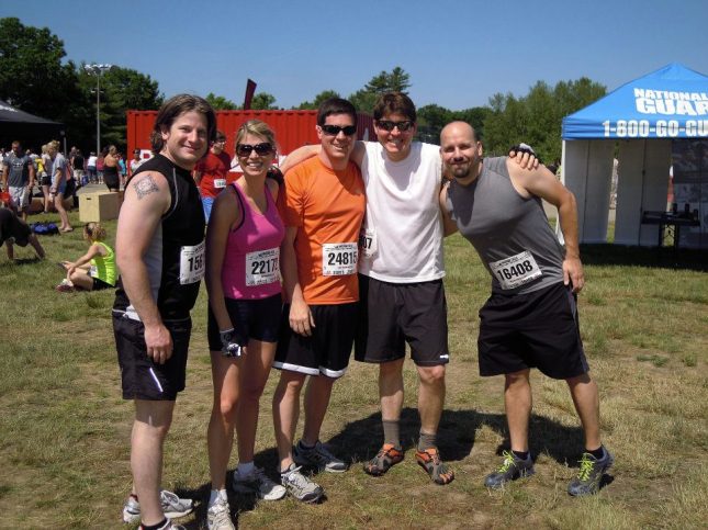
On June 10th, some members of the team we assembled for Tough Mudder (named Beer Wings, but we’ll get to that in another post) got together to tackle the Warrior Dash.  The 2012 New England event was held at the Thompson International Speedway in Thompson, CT.

Beer Wings: Before.  So, clean.  So shiny.

It was a hot day in New England, and we were ready for anything. We had decided to run the Dash as a team, and after the rally cry from the MC, and the flames exploded above the starting line, we were off! Or rather, we were walking along as the group of 400 of us hit the first challenge about .1 miles into the course. The first challenge wasn’t so much an obstacle as it was a muddy embankment into a cool creek. It was met with many screams as the cold water filled everyone’s shoes, but our little group was attempting to run at every moment to create some room for ourselves. We held our own really well, and slogged through the various mud puddles, patches, and creek beds that came up thigh high. The first obstacle was a muddy embankment which had a cargo net draped over it for some traction. However, the five of us skipped the cargo net section and just charged up the muddy slope using our hands for extra leverage. In no time, we were though that section and onto a slightly wider trail where we could begin to find our groove.

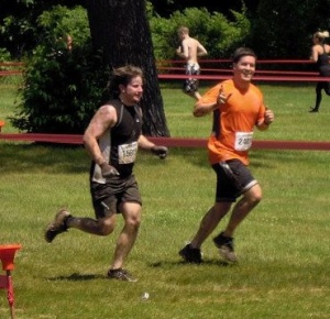
Scott & I running along

We settled into a nice easy pace, and came upon our next obstacle. Up and down some pitched balance beams, but not too difficult. I could see it being a bit more of a pain if it were later in the race, and your legs were tired. Next up, we had to hop over some barricades, and duck under barbed wire fences. Scott & I had gotten into a rhythm of scaling the wall, taking a couple of paces to the barbed wire, dropping and rolling through, hopping up and repeating the process. I don’t remember how many sections there were, but I remember being glad to finally get to the end of that one. Not long after, we were making our way through a tire field, up and over wrecked cars, up vertical walls, and down 20 foot poles. We held together pretty well through them all. Jack was falling back a bit towards the end, and waved us on.

Barb’s husband, Ryan, her children, and Drea were all on hand to spectate and snap some photos of us. Unfortunately, they weren’t allowed too far onto the course, so all their photos came at the end. However, some great obstacles were at the end, and they were able to grab some great shots of us!

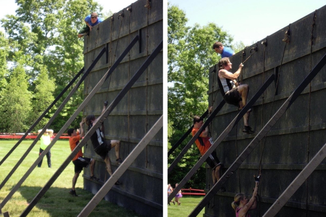
As we neared the end, we passed some firemen who were cheering us on letting us know that there was 3/4 of a mile to go.  But, in the last half mile there were four obstacles to take on.  The first was the 20 foot tall “Warrior Wall” which you had to scale up and over.

Scaling the Warrior Wall

I hit it really well, and was up and over in no time.  And, like we had been doing, I turned to back and was rooting on my teammates and waiting for them to join me.  Scott & Barb came over next, and as I was standing there waiting for Mike, I noticed that they kept running!  I had heard that Barb had a competitive streak in her, and it seemed like she was smelling the finish line.  So, I began giving chase.

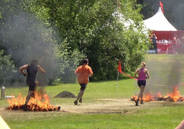
Next up, he had to jump through fire hurdles.  Scott had cracked me up by jumping up and clicking his heels over the fire, or so I thought.  When I questioned him later, he wasn’t actually trying to do that.  He was legitimately unnerved and was just trying to get his body as far from the flames as he could!  That made it even funnier.

I’m on F I R E !

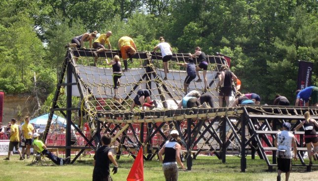
Once past the flames, we had the last vertical challenge of the day, the “Cargo Climb.”  You had to go up a few steps of a wooden ladder, and then scale across about 30 feet of horizontal cargo netting, up another 10 feet, and then down via more cargo net.  Well, as I came upon the obstacle, I found the spot where the center beam was, and decided to try to walk across the beam, tight rope style.  My legs weren’t nearly as fresh, and it got dicey at least once, where I almost crashed down into the net.  But, alas, I made it across with no issues.

Walking across the Cargo Climb

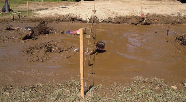
Once again, I was first off the obstacle and turned to wait for my teammates. And, once again, Barb just kept on running by!  So, I turned to jump run with her into the final obstacle of the day… a mud pit that you had to crawl through.

Underneath the barbed wire, you go!

There was some relief experienced being in the mud bath. Did I mention it was really freaking hot that day?

Barb & I are crawling out at the same time. (There is someone in between us, trust me, Barb is there).

Barb & I crossed the finish line just about together. To be fair, she beat me by 0.15 seconds. Not 15 seconds, mind you. But zero point fifteen seconds! But, on this day, it wasn’t about time. It was about team building and having fun. And, we certainly accomplished both!

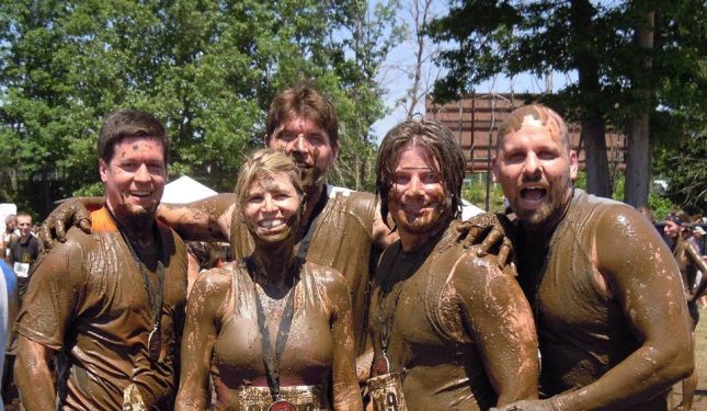
Beer Wings! Not so clean. Not so shiny.

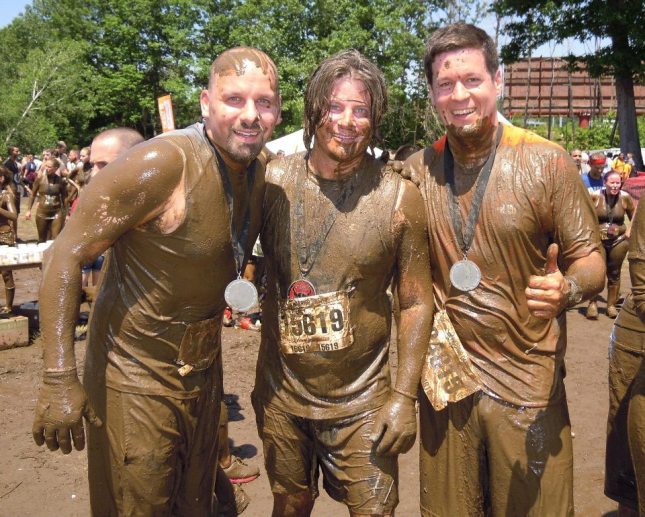
Mike, Scott, & I

Scott & I

For completing the Warrior Dash, we received medals, a t-shirt, and warrior helmets which we would wear on the summit of Lafayette a couple of days later. All in all, it was an awesome experience. It’s got me all amped up to do the Tough Mudder, and perhaps a Spartan Race or two. Additionally, I definitely want to go back and see how I do for time.  So, I’ll probably see you in 2013, Warrior Dash.  Only then, I will be running it much faster.


Tags: , ,

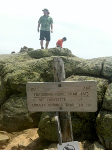
Hiking Franconia Ridge

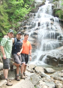
Scott, Mike, & I at Cloudland Falls

Mike, Scott, & I had decided to head up to New Hampshire to squeeze in some hiking.  So, on the morning of Tuesday, June 12th, we got started heading up to the Whites without having decided where we were going to hike exactly.  After some discussion, we had narrowed it down to either Franconia Ridge or Moosilauke.  Partly because they know I am working on the various lists, and partly because the weather was supposed to be great during the morning, we decided to hit up Franconia Ridge.  Scott & Mike had done this hike previously, but had never had good weather on the ridge.  They were hoping for a different outcome.  I had not read much about this actual hike, only had the views of the ridge (from across the notch) on my last hike fresh on my mind.

After parking at the Lafayette Campground hikers lot, we got onto the trail at 10:00am. We started up the Bridle Path to the junction of the Falling Waters Trail.  Crossing the bridge onto Falling Waters, I quickly realized how readily available I wanted my camera to be.

As the name implies, the trail follows, and crosses a couple of different brooks with waterfalls that increase in size the higher up the trail you go.  It really is a beautiful trail.  The first mile, mile and a half, seem to meander through the woods slowly gaining elevation.  It then begins a steep climb just before the largest of the waterfalls reveal itself.  Cloudland Falls is an 80 foot tall waterfall that was quite stunning.

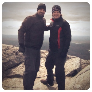
Two Scott’s on the summit of Little Haystack – Mike’s photo

The steep climb continues over the next mile or so towards the summit of Little Haystack.  At about 2.8 miles, we took the .1 mile spur path to the Shining Rock overlook.  Shining Rock has a consistent flow of water seeping down it.  From the floor of the Notch, it glistens in the sun earning its name.  Unfortunately, the overlook wasn’t much of one on this day, as it was quite hazy at that time.

Back up the trail we pushed.  My heart was definitely pounding as we ascended the last quarter of a mile up to the summit.  As the trees began to thin out and get smaller, my desire to reach the summit and, finally, stand on the Franconia Ridge only intensified.  Also, I was freaking starving and couldn’t wait to dig into a PB&J wrap!

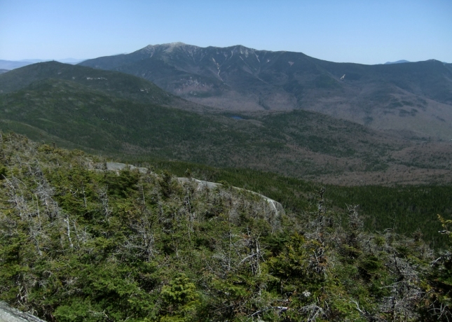
Even as hazy as it was, standing on the 4,760 foot summit of Little Haystack, it was readily apparent to me why Franconia Ridge is revered as one of the best stretches in all the 2,184 miles of the Appalachian Trail.  With 360˙ views, and the trail now above tree line, it is just a spectacular sight.  To the west, looking at the granite cliffs of Cannon & along the ridge to the Kinsmans, with Moosilauke hulking in the distance, I was able to reflect on previous hikes.  Looking to the east, overlooking Owls’s head, and off to the Bonds, and the south towards Liberty & Flume, I was dreaming of future hikes.  And to the north, miles of trail along the knife’s edge up to Lincoln and Lafayette were waiting to be imminently tackled.

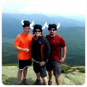
Warriors upon Lafayette

The next 1.7 miles were a nice easy jaunt, up and over Lincoln, and on up to Lafayette.  We paused up on Lafayette to don our Warrior Helmets earned a couple days prior at Warrior Dash.  It’s funny to me that people looked at us, but no one dared questioned why we were wearing such ridiculous garb.  We enjoyed the summit for a bit, taking in the views and enjoying the highest peak of the day (5,260′).

On the way up, I had been setting the pace for the majority.  Beginning the descent, I was going much slower.  I think I was making sure I wasn’t feeling anything in my knees on the rough terrain coming off the peak of Lafayette on the Greenleaf Trail.  Anyway, I caught back up with the guys just before the Greenleaf Hut.  We stopped here for a bit to use the facilities and grab a bit more water.  It was only my second time in a hut, having stopped at Lonesome Lake on my last hike.  Scott & Mike were extolling on the pleasantness of staying in one, and despite my desire to “tent it,” I’m certain that I will give a hut a try someday.

After leaving the hut, I felt like my legs were back and was able to continue on my normal pace for the last 3 miles or so, on the Bridle Path, back to the car.  It was a fairly easy 3 mile descent, with some great views looking back on the hike we had just conquered.

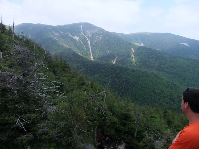
Scott looking back at Little Haystack, and Mount Lincoln

—–Hike Stats—–

  • Date: 6/12/12
  • Elevation: Little Haystack – 4760′, Mount Lincoln – 5089′, Mount Lafayette – 5260′
  • Elev Gain: I’ll have to, once again, go back and calculate the total elevation, but from Lafayette Campground to the summit of Mount Lafayette: ~3560
  • Mileage: ~9
  • Trails: Up:  Bridle Path -> Falling Waters -> Franconia Ridge Trail -> Greenleaf Trail -> Bridle Path
  • Time: about 6 hours.
  • NH 48 Peaks #6 (Lincoln) & #7 (Lafayette)
 
Leave a comment

Posted by on June 25, 2012 in Hiking


Tags: , , , , , , , , ,

Amazing Spring Day in the White Mountains

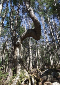
What makes a tree grow like this?

On Saturday, May 12th, I rolled out of bed early and headed on up to Franconia Notch for some peak bagging.  I had decided I would depart from the Lafayette Place Campground because that would provide the most options for the day.  I could bag Cannon and the North East Peak of the Cannon Balls.  Or, I could bag the Kinsmans.  Or, if I was feeling good, I could bag all four.  I had read in the AMC White Mountain Guide, that the approach to Cannon was fairly steep, so I decided to head their with fresh legs first.

I departed from the campground around 8:30 am.  It was a beautiful, cloudless morning and the temps were already in the 50’s.  I hit the Lonesome Lake Trail behind a couple of guys who had said they were heading towards the Kinsmans.  When I got to the turn-off for the Hi-Cannon Trail, they continued along the Lonesome Lake Trail.  The Hi-Cannon Trail was pretty narrow trail that had a few blow downs on it, but they were easy to step-over or duck-under.  The trail had several switchbacks, and before I knew it, I came to an unmarked trail junction.  I paused to catch my breath, and review the map, and couldn’t quite figure out what was going on.  According to the map, the Hi-Cannon Trail should have gone .8 miles before it reached a trail junction with the Dodge Cutoff.  I had read a recent trail log that mentioned that the Dodge Cutoff wasn’t marked well.  But, despite how hard I was sweating/breathing, I didn’t think I had gone .8 miles on that stretch.

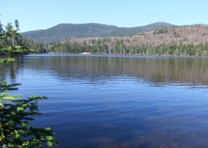
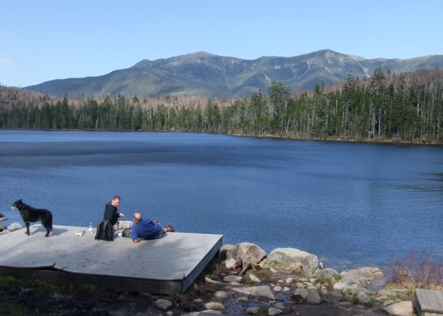
Lonesome Lake & the Kinsmans

As I was putting the map away, I saw the two guys hiking up the trail that were supposed to be going to the Kinsmans.  At that point, I thought, “Hmph.  I guess they changed their minds.”  But, I didn’t say anything.  I continued hiking ahead of them.  After a few moments, I found myself at the shores of Lonesome Lake, looking towards North Kinsman.  Somehow, I must have missed a trail junction while on the Hi-Cannon Trail, and ended up back on the Lonesome Lake Trail.  Whatever trail it was, wasn’t marked on my map and the intersection certainly isn’t marked on the tail, either.  It was a bit annoying as I knew it was going to add some unneeded mileage to my day.  But, no harm no foul.  I pressed on, deciding to continue up the Lonesome Lake Trail to Kinsman Ridge.  Over the next mile, half of it was fairly steep.

Once onto the Kinsman Ridge Trail, I started my ascent of Cannon.  Immediately, the conditions changed.  In the shadow of Cannon, the air was much cooler.  You could hear the wind whipping.  But, thankfully, I was mostly protected by the trees.  I saw my first evidence of left-over monorail patches, but they were very easily avoided.  This .4 mile section was quite steep, and had some areas that were hugging a cliff on a narrow trail.  Once past the junction with the Hi-Cannon Trail (grrr….), the trail eased up on it’s approach to the summit.  I stopped to pee check out the first outlook I saw just short of the summit, looking back over the Cannon Balls.  It was beautiful for sure.  But, I was blown away by the 360 degree views from the summit tower!  Blown away, both in amazement and the high winds.  I thought I was going to lose my hat!  It was definitely intimidating standing on that tower looking down at 93 below.  I’ve always looked up at the cliffs of Cannon (where Old Man on the Mountain used to be), and marvel at how steep it was.  And now, for the first time, I had the exact opposite perspective.  Crazy.  The views were beautiful; still no clouds.  But, there was a bit of a haze to the air as you were looking off into the distance.

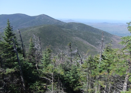
Looking along the Kinsman Ridge at the Cannon Balls & the Kinsmans

I turned around and started heading back down the Kinsman Ridge Tail to work my way to the North East Peak of the Cannon Balls.  I had remembered reading that it was an unassuming summit, but I thought there was some sort of marker.  Apparently, there was not.  I crossed the summit, barely acknowledging it’s existence without even slowing my pace.  I knew the Kinsmans would be more impressive, and I was on the longest trail section of the day.  At 2.4 miles from the NE Peak, to the Kinsman Junction, I had some work in front of me.  And, I have to say that I was not all that impressed with those 2.4 miles.  Very few views (I know. I’m greedy.) along those 2.4 miles, and no exciting nature sightings.  Blah.

Finally, I got to the junction and had to make a decision.  Do I continue on and bag the Kinsmans?  Or do I start heading back now?  I was definitely hungry.  I had not eaten my PB&J wrap yet, and it was calling my name.  I had been aiming to eat it on the summit of North Kinsman.  Plus, I had just done that long stretch of the Kinsman Ridge.  And to not summit the Kinsmans after that seemed like it would be a huge waste.  So, on I went.  (Sorry, Drea.)

I always get a bit excited when I start walking on stretches of the Appalachian Trail.  From the junction, the Kinsman Ridge Trail heading over the Kinsmans onto Moosilauke & beyond is part of the AT.  The .5 miles from the junction to the summit of North Kinsman was rather steep and was kicking my ass.  Lots of granite with few handholds. Once on the summit, however, I was awed by the view laid out before me.  Looking down into the valley to Lonesome Lake, with the amazing presentation of Mr. Lafayette, Lincoln, and Haystack just beyond.  It’s a truly gorgeous view.  Plus, the haze from the morning had definitely burned off.  It was warm at the summit, mid 60’s I’d estimate.  Great spot for lunch – glad I waited!

From North Kinsman – note Lonesome Lake (center) and the tower on Cannon (far left).

After finishing up lunch, I definitely felt alot better on my approach to South Kinsman.  Interestingly, just after leaving North Kinsman, I came upon those two guys that I started behind that morning.  We had a quick conversation about how our hikes had been going, before we continued on our separate ways again.  Of course, that span of trail is a pretty easy mile.  I spent some time on the summit, but wasn’t as impressed with those views, in comparison to what I just had on North Kinsman.  I had heard a couple of guys talk about nice views of Moosilauke further down the Kinsman Ridge Trail.  But, I was less than interested in taking any steps more than I had to.  I was definitely a bit tired.  As I posted on Facebook (yes, I posted on facebook from the summit, shut it):  “Pretty amazing day for peak bagging in the Whites. Four peaks down. But, I’m about 4 miles from my car. If someone could please have a helicopter meet me at the ledge on North Kinsman in about 20 mins, I’d really appreciate it.”

On the summit of North Kinsman

But, I underestimated.  It was actually 5 miles from the car.  And, they weren’t exactly the easiest five miles I’ve ever done.  The mile back to North Kinsman was fine.  But, the .5 mile back down to the junction, was that steep section on granite with few hand holds.  I was certainly taking my time with my fatigued legs.  Once at the junction, I jumped on the Fishin’ Jimmy Trail.  This was also part of the AT and I don’t think I had actually read up on this trail, at all.  The trail is in good condition, but it is steep and most of it is slippery granite.  There are several sections where there are stairs bolted into the granite to help you out (again, no hand holds).  Those were very handy.  I did notice one was missing/broken.  But, it’s the AT.  It will be repaired soon, I am sure.  Regardless, for a good mile or so, my pace was reduced to crawling.

For some reason, I had it in my head that the Fishin’ Jimmy Trail was only 1.5 miles long.  In actuality, it is two.  That’s not much of a difference, but my legs were shot.  That half mile was feeling much longer.  Additionally, I drained my 3.0 litre reservoir for the first time ever.  That was probably about a mile from the Lonesome Lake Hut.  Of course, as soon as it was gone, all I wanted was more water.  The hut was a welcome site!  I refilled, grabbed a candy bar, and continued on down the trail.  I didn’t get far before being presented with yet another amazing view over Lonesome Lake.  What a beautiful spot!

What. A. Day.

The rest of the hike was uneventful.  It was a long, but great day on the trails.  There were tons of people out enjoying the day.  And, many had their dogs with them.  (It made me want one, even more than already do!)  I was also slightly jealous of everyone that was backpacking; heading to various shelters/huts/camps for further communing with nature.

—–Hike Stats—–

  • Date: 5/12/12
  • Elevation: Cannon – 4100′, Cannon Balls NE Peak – 3769′, North Kinsman – 4293′, South Kinsman – 4358′
  • Elev Gain: So many gains and losses – but from the Laffayette Place Campground to South Kinsman: ~2558
  • Mileage: 13
  • Trails: Up:  Lonesome Lake -> Hi-Cannon -> Unmarked Link -> Lonesome Lake -> Kinsman Ridge Trail -> Cannon -> back via Kinsman Ridge to Cannon Balls -> North Kinsman -> South Kinsman -> North Kinsman -> Fishin’ Jimmy Trail -> Around Lonesome Lake Trail -> Lonesome Lake Trail
  • Time:  8 hours 25 mins.
  • NH 48 – Peaks #3 (Cannon), #4 (N. Kinsman), & #5 (S. Kinsman)
 
Leave a comment

Posted by on May 14, 2012 in Hiking


Tags: , , , , , , , , ,

Odometer Musings

The Red Dragon (thanks for the name, Bob) has turned 185k! I must be slowing down.  Or perhaps I listened to Drea, because it took 198 days this time. 15k to the big 200!

20120510-172357.jpg

 
Leave a comment

Posted by on May 10, 2012 in Random


Tags: ,

Blue

A blue lobster on a Blue Pearl yields a blue Sunday.

Blech. 20120429-145315.jpg

 
Leave a comment

Posted by on April 29, 2012 in Random


Trouble

Sometimes, these three are just cute.

We had been in Target to pick up dress shoes for the kids.  And, somehow, they all ended up finding hats they just needed to have.  (I did not advise them on how to wear these hats.)

 
Leave a comment

Posted by on April 27, 2012 in Kids


Tags:

The Birth of a Highpointing Family

Everyone knows that I have been bit by the hiking bug in a big way.  As a result, peak bagging lists seemed a natural progression.  I’ve pointed out some of the ones I am keeping track of in a previous post.  Well, since then, I have certainly added the Catskill 3500 list into the mix.

But, those limit me to the Northeast region.  And, I want to explore as much of this country as possible.  And, I want to show my kids as much of this country as possible.  So, a list that I’ve decided to tackle, and my children and Drea have embraced have had pushed onto them is – Highpointing the 50 States.

I saw your eyes glaze over.  It is ok.  It’s the same thing that happened when I described it to Drea (that is, until she realized that Hawaii had a highpoint).

So, you are wondering, what is highpointing?  Well according to wiki:

Highpointing is the sport of visiting (and finding) the point with the highest elevation within some area (the “highpoint”), for example the highest points in each county within a state. It can be considered a form of peak bagging.

  • The goal is to attain the highest “natural point.” In other words, regardless of what man-made structures have been placed on top, the goal is to stand atop the highest “natural point.”
  • If the natural high point is covered with a structure and that structure is accessible, even on a limited basis, entering the structure and standing over the presumed high point is the goal. If the structure is completely and permanently inaccessible—e.g. a military base or private telecommunications tower – the goal is to reach the highest accessible natural point. At times, The Highpointers Club will deem a highpoint closed due to private property issues and may allow an alternative spot very near the highpoint. But, this is only in extreme and special conditions. Some of the highpoints are open on certain dates only and the Club expects all members to abide by these dates.
  • Any route to the top – walking, climbing, riding a cable car, dropping off a helicopter – is a valid means of attaining the high point. Each individual must decide what constitutes good sport. Many will prefer reaching the high point under their own locomotion, but the goal of highpointing is reaching the highpoint – means is a personal choice.

Still with me?  Ok, good.  As mentioned in the wiki quote that you just skipped over, I’m not alone in my desire to reach this achievement.  And, just like any other subject, when there is more than one person trying to achieve a similar goal, someone formed a Highpointing Club.  (So, what if the most prominent photos on their homepage seem to indicate that the average age of members is deceased!)  And, there is this view point from my list-obsessed friend Steve, who’s reasons for wanting to tackle highpointing list aren’t too dissimilar to my own.

With regard to the last bullet, when possible, I fully intend on taking the hiking approach.  For example, the high point of New Hampshire is the summit of Mount Washington.  Now, everyone and their grandmother could drive up there.  Boring.  Or take the cog railway.  Really?  Come on!  Where is the adventure in that?  Where is the challenge?  Where is the journey?  Not for this highpointer.  I’ll be taking the long way, thanks.  (Not to mention that Mount Washington is on my NH 4000 & NE 100 lists… but my point still remains.)

Curious what the highpoints of your favorite states are?  You know you are!  Here’s a map view.  And, here’s a list.

DSCF2923

Close.... but not the true highpoint.

All right, with all of that said, it only seemed logical to tackle the home state’s highpoint as the start of this adventure.  And, as I had the children for April Vacation this year, and I’ve been starving for some hiking, the time was right to dip our toes into the highpointing waters.

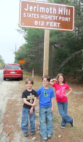
Now, Rhode Island’s highpoint is truly a massive summit of 812′ on the top of Jeromith Hill.  Shockingly, this is not the lowest high point of the United States; that honor belongs to 345′  Britton Hill  in Florida. (Of course it does, Florida gets all of the freaking rejects.)  Despite it’s minor elevation, Rhode Island’s highpoint was not-too-long-ago known as one of the most difficult highpoints to achieve, due to land owners that were particularly ornery and trigger-happy.  Yes, I said trigger-happy.  Check that link out!  Thankfully, all of that nonsense is in the past, and RI’s highpoint is accessible 7 days a week between the hours of 8am & 4pm.

So, on Sunday, April 15th, we took the drive out to Foster, RI.  Upon driving up the numerous hills along Route 101, I was struck with how significant some of them seemed; a few of them had several hundred feet elevation change between them.  From the East, you pass a highway sign that indicates you are on Jerimoth Hill, it even indicates that it is the state’s highpoint.  However, the true highpoint is not actually on the highway.  After passing the sign, we did a U-turn and found the matching sign on the other side of the road.  We parked and climbed out of the van.  It was only then, that I told the kids what we were there to do…. and that they had to hike to do it!  This was met with some shock, guffaws, and some grumbles.  All of which, I was expecting.  They asked how long of a hike it would be, and I assured them, it would be the shortest hike of their young lives.

DSCF2919

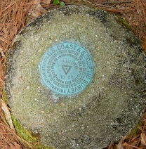
We followed the big conspicuous red sign indicating the legendary Jerimoth Hill Trail.  We labored up the pine needle riddled trail from the main road about 50 yards and stumbled upon a survey marker.  But, alas, that was a false summit.  Undaunted, we pressed on.

DSCF2918

Not a summit marker...

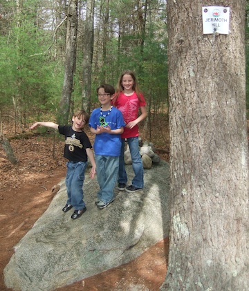
After another 25 yards, or so, we arrived, exhausted, at Rhode Island’s true highpoint.  It was a beautiful sight to behold; encircled in trees was a hunk of granite protruding from the ground, with a cairn 2 or 3 feet high erected on top of it.  The views were grand… Nope.  There were no views.  But, dammit, we became highpointers this day!  One down, 49 to go.

DSCF2911

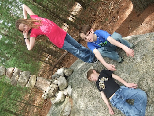
The kids on the summit! Yay! (This was also the start of Brady trying to sabotage *every* photo with some ridiculous pose or face.

The children... exhausted after the monster hike!

 
10 Comments

Posted by on April 25, 2012 in Hiking, Outdoor Adventures, Travel


Tags: , , , , , ,

A Bathroom Surprise

I’m waaaay behind in my blogging and much has happened.  I’m going to try to play catch-up a bit this week.  The posts may not follow a true timeline – but, no problemo.

Silly tourists doing tourist things.

Back in the first week of March, Drea & I took a long-overdue vacation to the Riviera Maya in Mexico.

Now, based on the title of the post, and the fact that we went to Mexico, you are probably making inaccurate conclusions about what this post is actually about.  Rest assured, neither of us were victims of Montezuma’s Revenge or is this post about poop at all.

We had a great time down there.  Really, it is difficult to travel to Mexico (the tourist-safe areas anyway) and not have a good time.

We spent one day walking up and down 5th Ave in Playa del Carmen.  We went to Señor Frogs for lunch.  But, the scene was pretty lame.  Apparently, during the day, Señor Frogs is a pretty family-friendly place.  It’s not until night time that it picks up.  Not interested in hanging with the families and over-paying for mediocre food & drinks, we moved on.  We then found ourselves ordering a bucket of beers at the Tequila Barrel.  We met a couple from Canada and had a nice time chatting and drinking with them.

Drea doing her Vanna impression

At some point, we had asked our bartender for the best places to hangout in Playa.  We told him we wanted the real flavor, somewhere locals would go, as well.  He told us about a few dance clubs that he would be hitting that night.  Those aren’t exactly Drea & I’s scene, but he did seem to have his finger on the pulse of the area.  So, we asked where we could get the best authentic Mexican food.  He immediately started talking about Mi Pueblo.  This excited Drea & I because we had actually eyed this restaurant earlier and thought it had potential.

Mi Pueblo was everything we could have asked for and more.  A quaint little restaurant in the heart of Playa.  Our only issue with the restaurant was that after looking over the menu for several minutes, a waiter dropped an iPad on our table that had photos of each dish.  We had already been having a difficult time narrowing down what we wanted to order because everything sounded delicious.  You would have thought that the photos might have helped.  Nope.  Exactly the opposite!  Not only did they sound good, but everything looked freaking fantastic!  All the iPad did was complicate the ordering process.  Since there were only two of us dining, it would have been incredibly wasteful for us to order one of everything on the menu.  But, that’s exactly what we wanted to do!

The door to a magical land...

After settling on dining options, Drea excused herself and disappeared behind the door that was emblazened with one Spanish word every gringo knows – baños!

Upon her return, she exclaimed “That’s not at all what I expected behind that door!”  Despite that confusing me, I ignored her pleas for me to go to the bathroom.  For the first time in ever, my bladder wasn’t acting like it was the size of a damned pea.  I enjoyed our beverages, our apps, and my main course (all of which lived up to our lofty expectations!), before even feeling the urge.

Finally, I did.

And, holy shit was she correct!

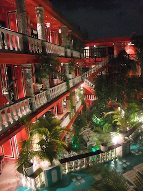
What I found was this beautiful courtyard of this stylishly appointed boutique hotel.  The bathroom was actually a flight or two down the stairs within the courtyard.  (A couple photos are below.)  I really was wishing I had been able to get a peak into some of the rooms.

I was curious about the hotel, Hotel Jungla Caribe, upon returning back to the states.  It looks well appointed, has favorable reviews on Trip Advisor,  and it’s cheap.  Drea & I actually have a wedding to attend in the area next year, and we may try to spend a night or two here.

Looking over the courtyard. (Not shown - the pool)

Love the look of the hallway...

 
Leave a comment

Posted by on April 24, 2012 in Travel


Tags: , , , , ,

An April Fools Day Hike Up Monadnock

On April Fool’s Day, two fools headed up the second most hiked mountain in the world; Mount Monadnock.

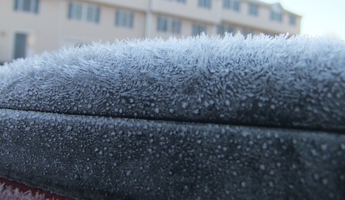
Well, that sounded like a good opening line.  In all honesty, there was nothing foolish about this endeavor.  It was a gorgeous morning.  Even if it did start with finding the van encased in a frost that almost appeared hairy on closer inspection.

After heading out from Waltham, and making record time, I arrived in good ol’ Jaffrey, NH around 9am.  As I was spearheading this hike, I had suggested we hike a trail that neither of us had ever hiked before.  The only issue was that I wasn’t exactly sure how to tell Mike, who didn’t have a Monadnock map on him, where to meet me.  I had sent a text telling him to head to the main lot area, but to follow signs for the campground.  Unfortunately, there weren’t really any signs directing you towards the campground.  A few texts later, and I was able to get the right directions into his hands.

Besides, our cars, there were only two other cars in the lot.  That alone was enough to tell me that his hike would be different from previous hikes up Monadnock.  Often times, you end up passing more people than you can count on these trails.  And, had we chosen one of the other main lots, that may have been true for this hike.  But, on the way up, we only saw three other hikers, and one was a woman that caught up to us at some point.

We started up on the Birchtoft Trail, which heads up the east slope of the mountain.  It is quite a gradual incline, as compared to some of the other trails I have taken.  It really wasn’t until we crossed the Cascade Link trail and onto the Red Spot Trail (guess what the trail markers were!), that the real steepness kicked in (about 600 vertical feet in 1/2 mile).  But, this approach still feels “easier” than that of the White Dot or White Arrow trails.  About a 1/4 mile from the summit, the Red Dot Trail merges with the Pumpelly trail and meanders it’s way across the granite to the summit.

As you can tell from the photo above, the clouds had started to roll in by the time we reached the summit, but it was pleasant up top.  I had hiked in only a thermal shirt the entire way up, and only needed to throw another layer of warmth and a windbreaker to remain comfortable as we rested.  The temps at the summit were probably mid 30’s and the winds were very light.

On the way down, we decided to check out the Pumpelly trail a bit further.  I expect that I will be hiking this trail a few more times in the future as I try to find the Pumpelly Cave.  The trail itself, follows a ridge that provides some nice views to the north of the mountain.  About a mile and a half from the summit, we hopped onto the Cascade Link.  The Cascade Link was certainly the more technical of the trails that we hiked this day.

It was a fun day on the trails.  It just made me even more eager to get out and do more hiking.

—–Hike Stats—–

  • Date: 4/1/12
  • Elevation: 3165
  • Elev Gain: 1807
  • Mileage: 5+?*
  • Trails: Up:  Birchtoft -> Red Dot –> Pumpelly.  Down:  Pumpelly –> Cascade Link -> Birchtoft

*Something that drives me bonkers about the maps handed out by the Monadnock Park Staff is that it does not include any trail mileage. Yes, there is a 1/2 mile representation in the legend… but most good hiking maps have the mileage markers for each trail printed near the mid point of the trail.  Given that this is the second most hiked mountain in the world, attracting tons of families, and first-time hikers annually, you think that the maps would be better.  Seriously, NH Parks & Recreation, get on that!

 
Leave a comment

Posted by on April 3, 2012 in Hiking


Tags: ,

This is a sweet video on the proper mechanics of running. And, given that I am sure I have fallen into horrid form during my years of (lack of) training, it is a helpful video for me.

51feetunder

Have you ever run barefoot?  Or been curious about the “how’s” & “Why’s”?

Check out this great video from the folks at the Natural Running Center, and Dr. Mark Cucuzzella.  Barefoot running or not, this video has some great points about form and biomechanics which every runner should be aware of.  Give it a clicksee…

Vid graciously stolen from Runblogger, and Running & Rambling

Have a good one kids!

View original post

 
Leave a comment

Posted by on March 8, 2012 in Random